
My Trusted DC Pocket Map
No question about it…my sense of direction stinks.
Growing up in Chicago, with its tall landmark buildings and logical grid block system, I found it easy to navigate the city. Since I moved away, I think I left my sense of direction somewhere near Wrigley Field. It got so bad, that I bought myself a GPS device.
Since it’s not convenient to carry my bulky GPS around with me once I leave the car, Metro or while riding my bike, I still carry a map of Washington, DC when out exploring.
And just in time for Washington’s summer tourists season, let me tell you about my new favorite Washington, DC maps, the family of compact Streewise Maps.
These colorful laminated and foldable, two-sided maps are ideal for travelers and local alike. They are small, easy to read, and are very detailed for their size.
Some of the features I like about these maps are that they use a color coding system to easily identify the types of buildings (red for museums and monuments, blue for government buildings, gold for hotels, etc.), detail the driver frustrating one-way streets, identify where all the Metro subway stops are, and have an easy to calculate distance grid around the boarder. Plus, they are virtually indestructible.
They have three map options for Washington, DC:
The Streetwise Washington, DC map ($6.95) offers a:
- More traditional DC street map. It covers from Arlington, VA on the west, north to the National Zoo, east to National Arboretum and south as far as the SE Waterfront.
- Detailed inset map of the Mall.
- Regional map that covers from Quantico, VA to Baltimore, MD.
- Metro subway map and map of area shopping malls close to the subway.
- DC Street, building, point of interest and area town index.
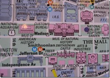
Artwise Washington, DC, is their museum map ($7.95) has a slightly smaller coverage area which:
- Highlights all of the museums, theaters, hotels and major attractions.
- Metro subway and nearby shopping mall map.
- Museum listing and description with the museum’s address, phone number, hours and admission information.
This map is recent enough to list the Newseum, which opened in April 2008.
The last map, the Mall & Metro mini map ($1.95) is probably my favorite, due to its small size, but big punch.
- In a 4″ x 8″ tri-fold format (4″ by 2¾”)
- Covers the National Mall on one side and the Metro subway map on the other.
There are also another state map version as well, that covers DC, Virginia, West Virginia and Maryland. and streetwise make city maps for most major U.S. metro area and Artwise maps for cities around the globe.
The maps are available online from directly from Streetwise, from online retailers like Amazon or at many chain bookstores.
Images - compass, hand drawn map, map images - from personal collection - ©2008, Jon Rochetti
_____________________________________________
Comments Off