
Getting Around DC – Part 2 – Driving in the District - Street Layout
Washington DC can initially be a confusing place to get around in on foot or by car. Understanding the basic framework of streets, avenues and circles can make traveling in DC significantly easier.
It’s rumored that the city’s primary planner, Pierre Charles L’Enfant, designed the city to confuse potential invaders. Well, he probably succeeded in confusing at least a good portion of the tourists some 200 years later. Once you understand the city’s grid, numbering and street naming system, getting around is fairly easy. Besides, if you’re planning on invading…you’ll first need a government permit.
General City Layout
Washington DC is a city divided into of four sections consisting of Northwest, Northeast, Southeast and Southwest quadrants. Streets are laid out in a basic grid pattern. And all addresses are designated with their quadrant: NW, NE, SE, and SW.
How the Street and Avenue Numbering System Works
Numbered streets (1st, 2nd, 3rd Street, etc.) run north-south while lettered streets (A, B, C Street, etc.) run east-west. After all the letters were used, street names are generally words or names named in alphabetical order, starting with double syllables, then triple syllables, then four syllables as you progress further from the city’s center. So streets such as Davis and Garfield Streets are closer to the city’s center than are Appleton and Patterson Street. There are of course a few exceptions, but you can find most destinations using this system.
The numbering and lettering system begins at The Capitol Building and works out in all four directions. So, for example, 3rd Street is the third street from The Capitol – in all directions. This is where it can get a bit confusing, as there are many cases, four similarly named intersections, such as 4th and D Streets NW, SW, NE and SE. So to make sure you are where you need to be, pay close attention to the suffix or designation after an address. Fail to pay attention and you could end up blocks from your intended destination.
Avenues
Avenues run at diagonals across the city. They are named after the states - New York, Pennsylvania, Wisconsin Avenue, etc. They can be fast cross-city short-cuts.
Traffic Circles
Although the urban legend about the car full of tourists that arrived in DC in 1997 and are still stuck circling Dupont Circle trying to find a way out is grossly exaggerated; DC’s traffic circles can be a bit confusing.
There are at least ten major DC intersections with circles, all with several streets and avenues converging, such as Dupont Circle and Logan Circle. When driving through a circle, pay close attention to traffic lights, traffic flow and signs. And remember, the street you are driving on may not continue exactly on the opposite side of the circle. It may continue off at a different angle, or worse not at all.
The most famous circle, Dupont Circle, was even mentioned in the movie, The American President with Michael Douglas and Annette Bening. In the film, the President’s girl friend is late getting to the White House and the President asks her if she got stuck on Dupont Circle yet again. She replies by asking the President “Can’t you declare it a Federal Disaster Area or something?” It’s understandable how someone could get confused as Dupont Circle intersects five roads (10 spokes) and includes an inner and outer ring, multiple traffic signals, plus an underpass. Perhaps that rumor about the trapped tourists is not quite so exaggerated!!!
One-Way Streets
Many of DC’s streets are one-way, so it’s wise to pay attention. A few streets, especially near The Capitol Building, the Mall and in parts of downtown may be one-way in one direction in the morning, the other direction in the evening and two ways at all other times. Again, watch for Do Not Enter signs and check the sign for specific hours. When in doubt, it’s usually safe to just follow the traffic flow.
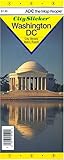
It’s smart to carry a quality map of the National Mall and downtown areas as well as the suburban area. My favorite map is a laminated city & metro area map by CitySlicker ($7.95). It also includes a Metro subway map, descriptions of major points of interest, a street guide and other valuable information. Plus, it’s easy to fold. Just click on the map to order it from Amazon.
For a bit of additional info on DC’s original design plan, check out my earlier post.
Comments Off